On my way back to LA and I decided to take a different route.
You know – the road less travelled.
I fueled up The 55 at the Evergreen Conoco station and took CO-73 towards Conifer where I got on 285 to Buena Vista.
At Buena Vista I made a left and continued on 285.
After awhile I noticed what looked like a big pile of sand off to my left.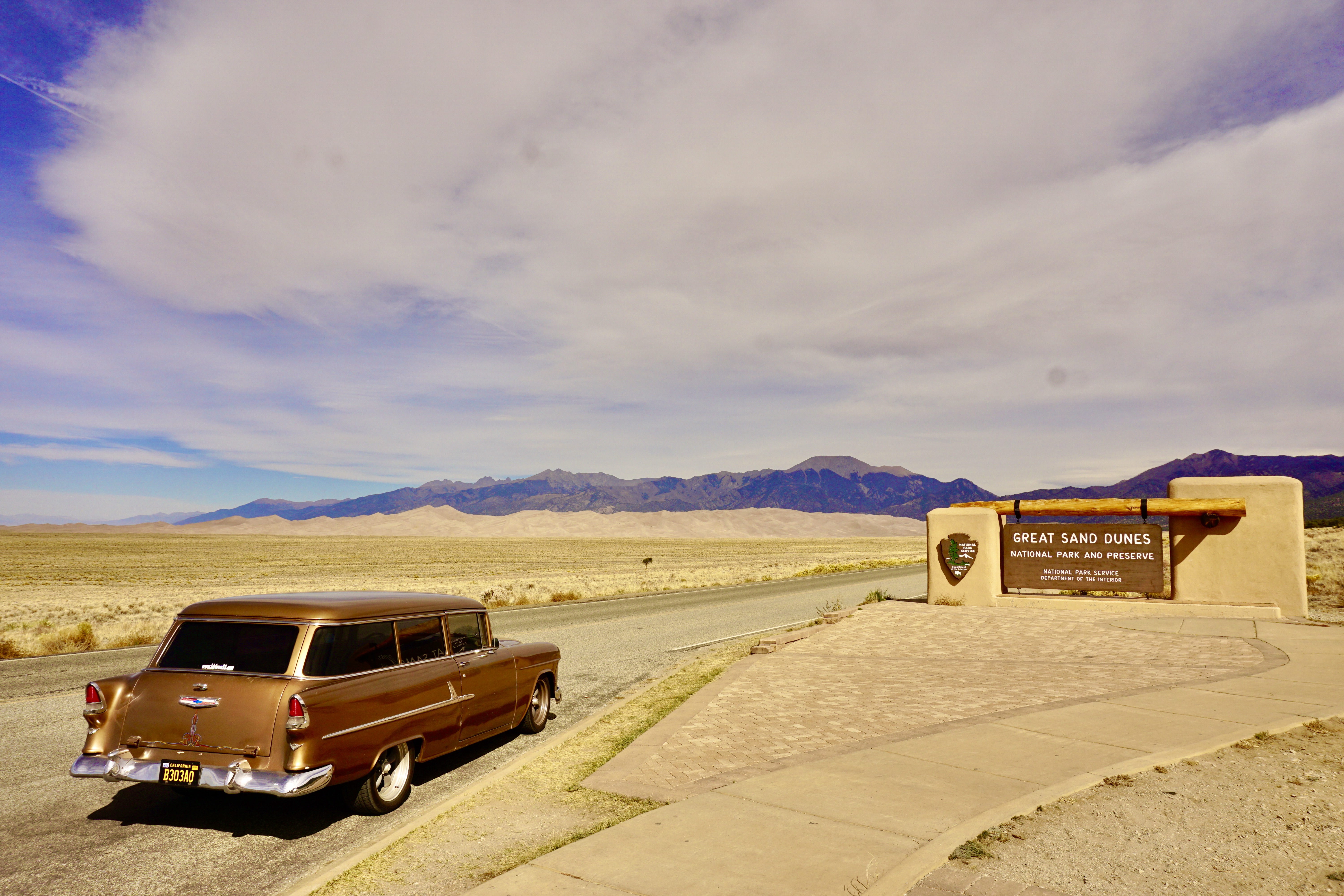
That big pile of sand is the Great Sand Dunes National Park.
I hadn’t been there since I was a kid.
Back then we brought an old ironing board to “board” down the sand dunes.
From the Great Sand Dunes National Park we got on the Los Caminos Antiguos Scenic Byway.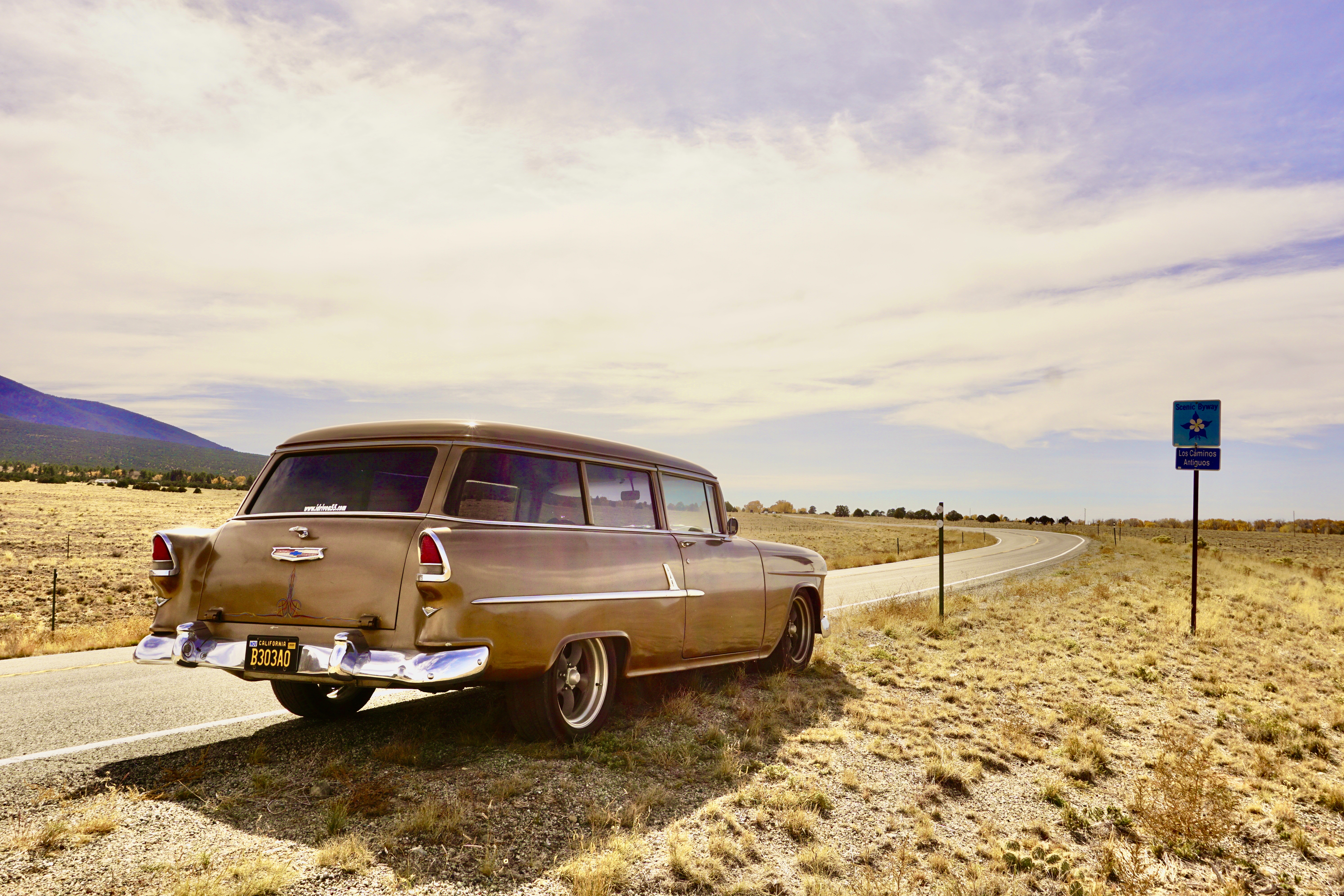
It’s one of Colorado’s many Scenic Byways.
It’s not an America’s Byway – but it’s still a beautiful drive.
We drove thru Alamosa and then Monte Vista where I spotted Hope’s Castle.
Hope’s Castle was built as an armory in 1922 and it used to be a restaurant too at some point.
After Hope’s Castle I came across a drive-in / motel – the Best Western Movie Manor.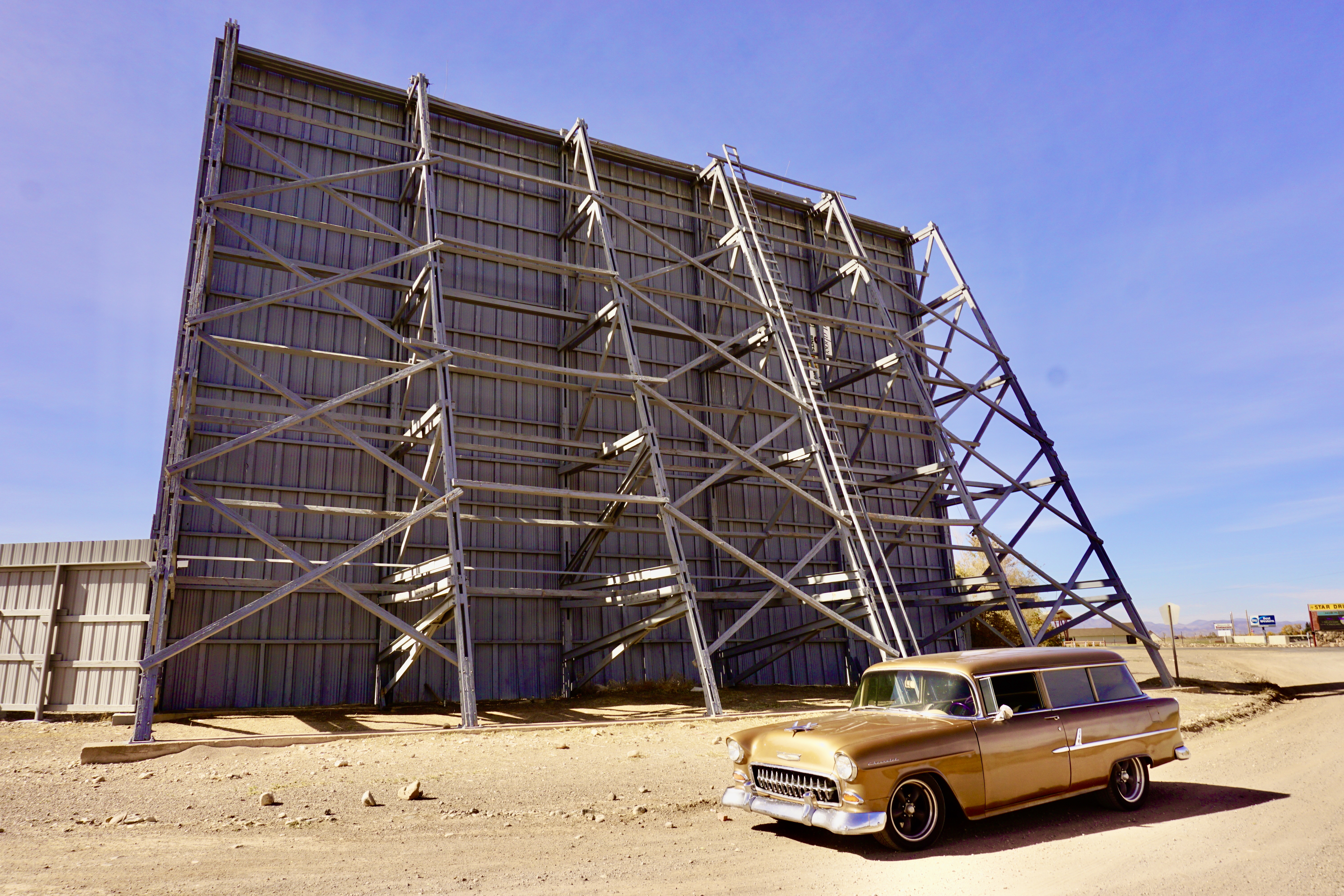
The motel is set up so each room faces one of two drive-in movie screens so you can watch the movie from the comfort of your motel room.
Pretty cool right?
Just down the road is the “Rain of Giant Arrows.”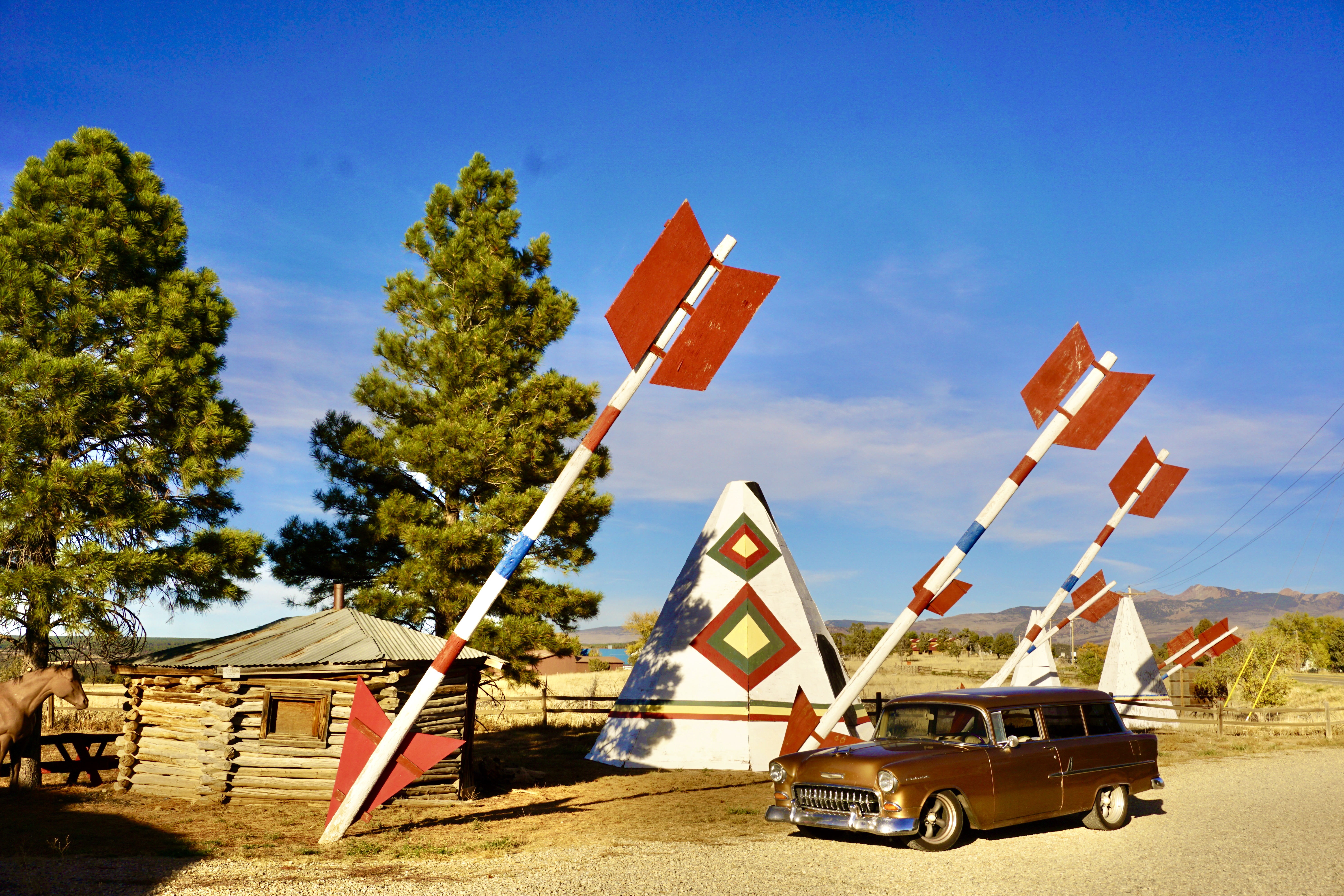
There are about 30 giant arrows that are made out of telephone poles and three wooden teepees that were installed in 1959 to attract tourists.
From the arrows Mesa Verde National Park was just down the road.
I had been there before but I didn’t get a picture next to the sign.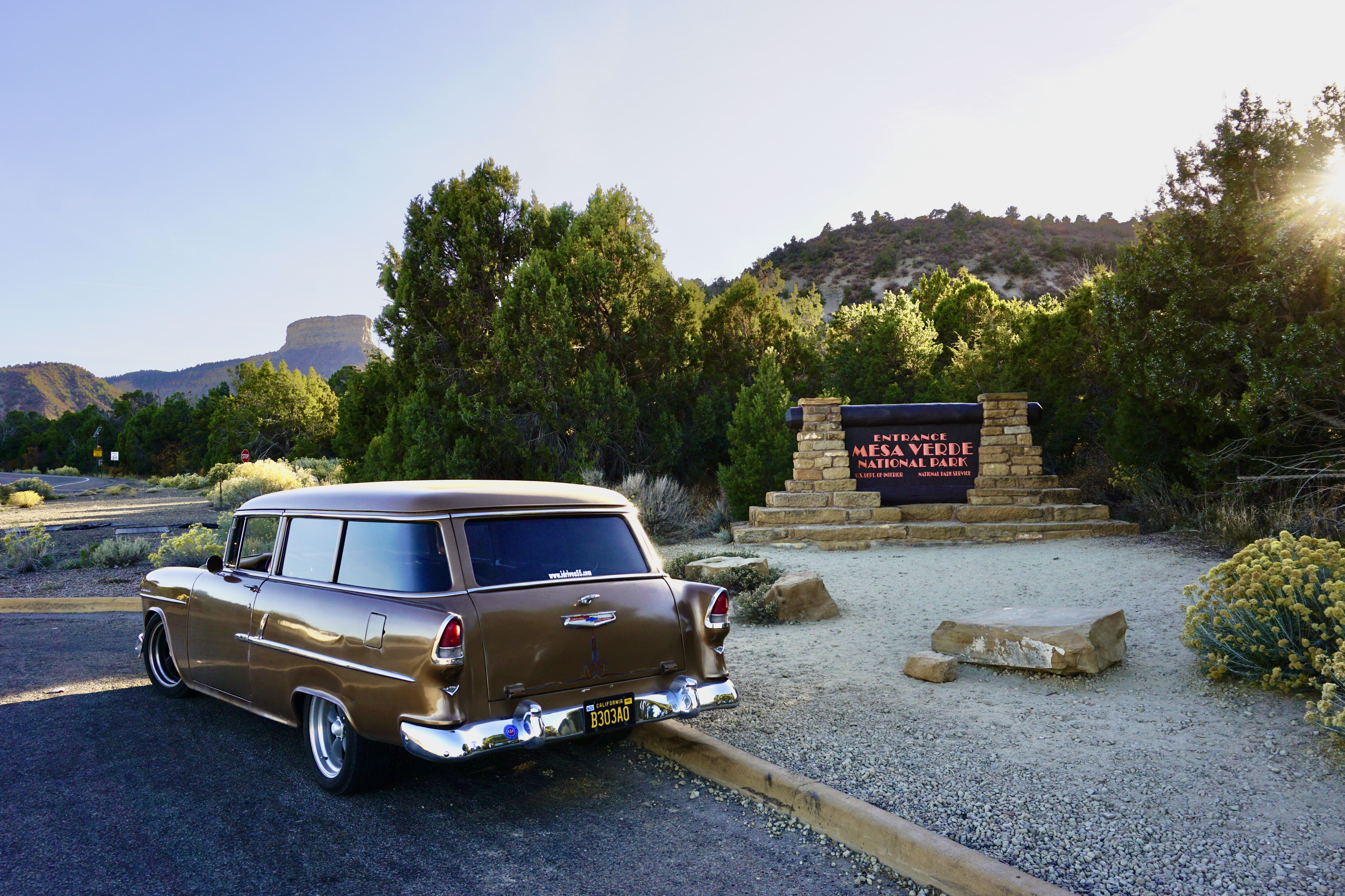
Great success.
And we got another one of Colorado’s Scenic Byways – the San Juan Skyway. 
The San Juan Skyway is designated as an “All-American Road” which makes it even more special.
It travels thru Colorado’s gold country and has the nickname “The Million Dollar Highway” either because that’s how much it cost to build or because that’s the amount of gold left in the road-fill.
I think the nickname is because of the million-dollar views.
I spent the night in Cortez with my friends Dick & Karyn Eytchison.
Karyn made an awesome crescent roll lasagna.
Yeah – you read that right – crescent roll lasagna.
It was delicious and I even got the leftovers for lunch the next day.
I left Cortez the next morning and headed towards the Four Corners.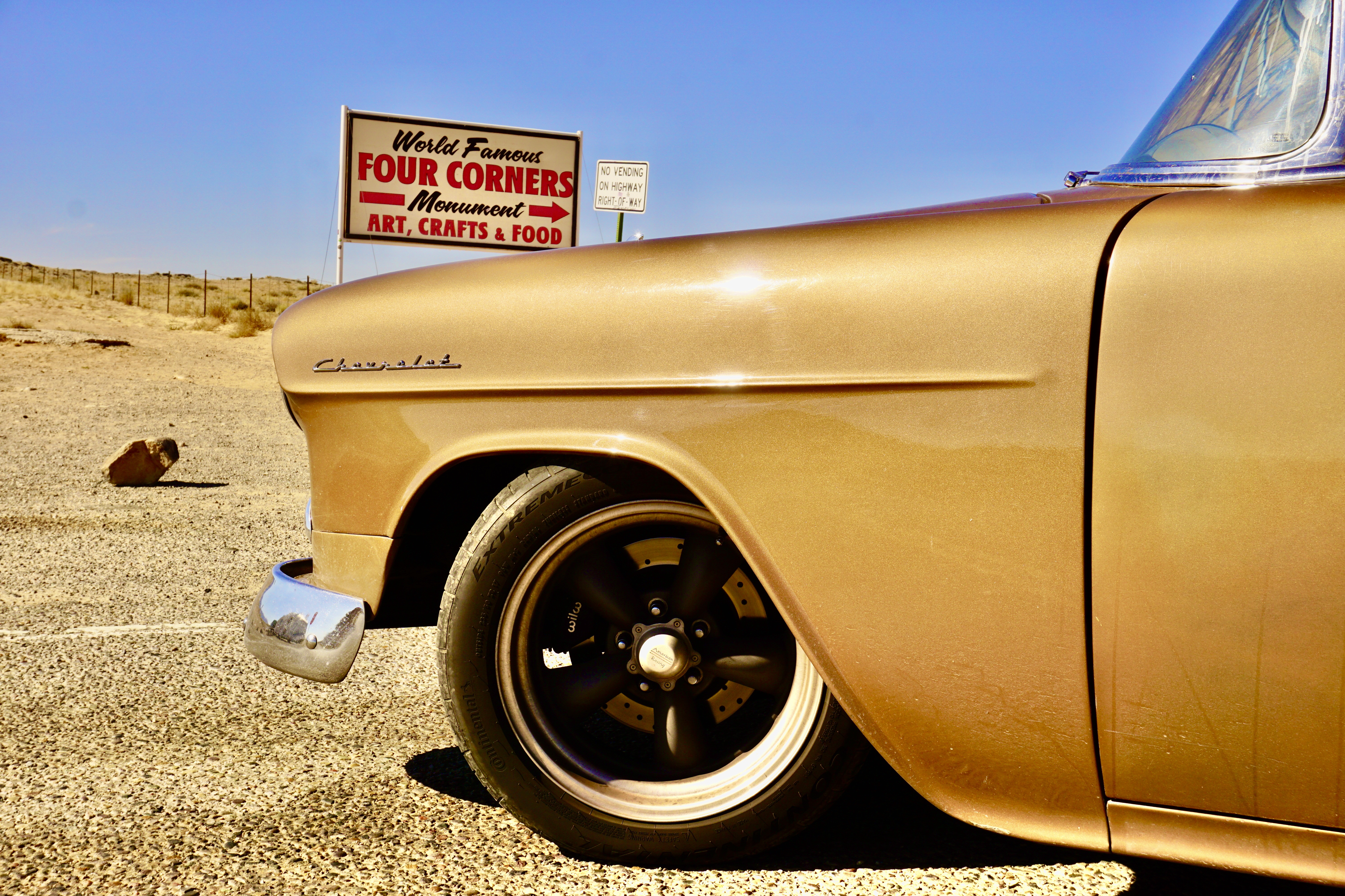
It was closed…
So was this abandoned gas station.
We drove from Kayenta to Tuba City to Cameron.
At Cameron we turned right onto AZ-64 and headed towards the Grand Canyon National Park.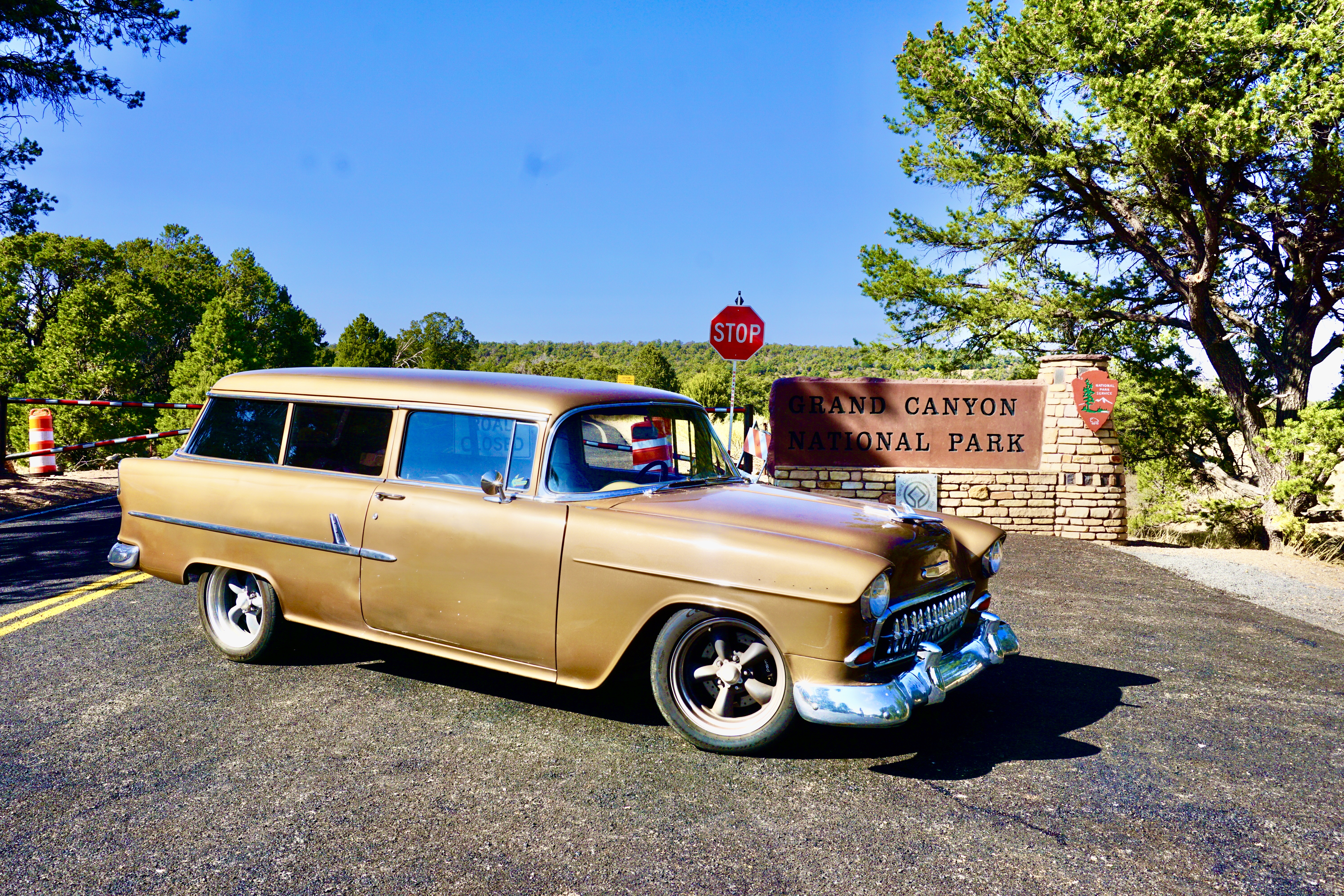
The park was open but this entrance was closed.
But I didn’t care because the drive on AZ-64 was gorgeous!!
I got back on AZ-89 and headed south towards Flagstaff.
Before we got to Flagstaff I had to stop off at the Scared Mountain Service Station.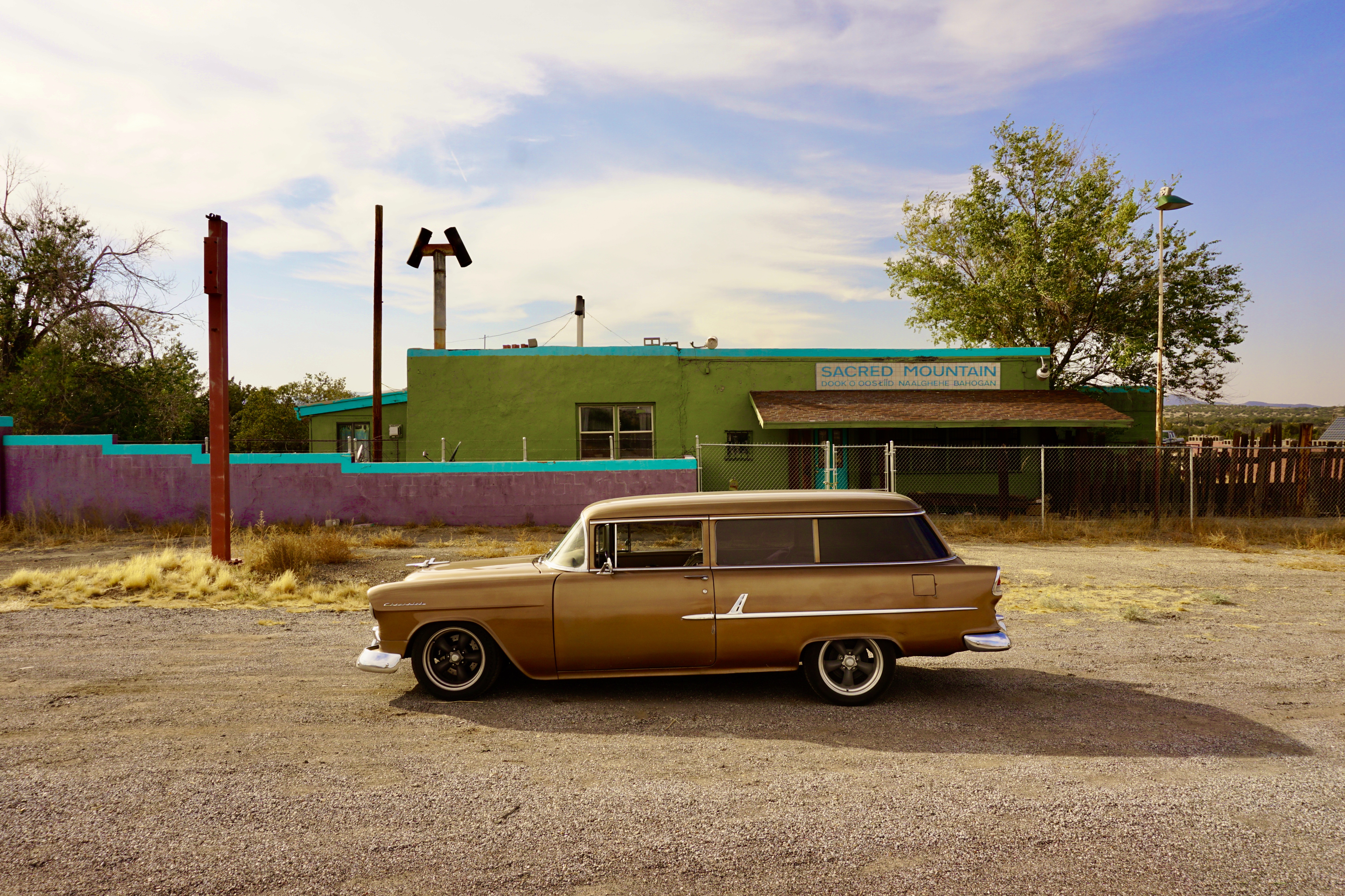
This is the place Wyatt & Billy stopped for gas in the film “Easy Rider.”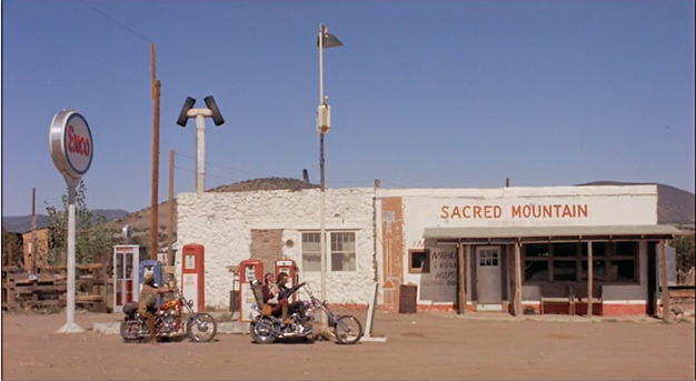
Just down the road I found another piece of Hollywood gold – Mary’s Cafe.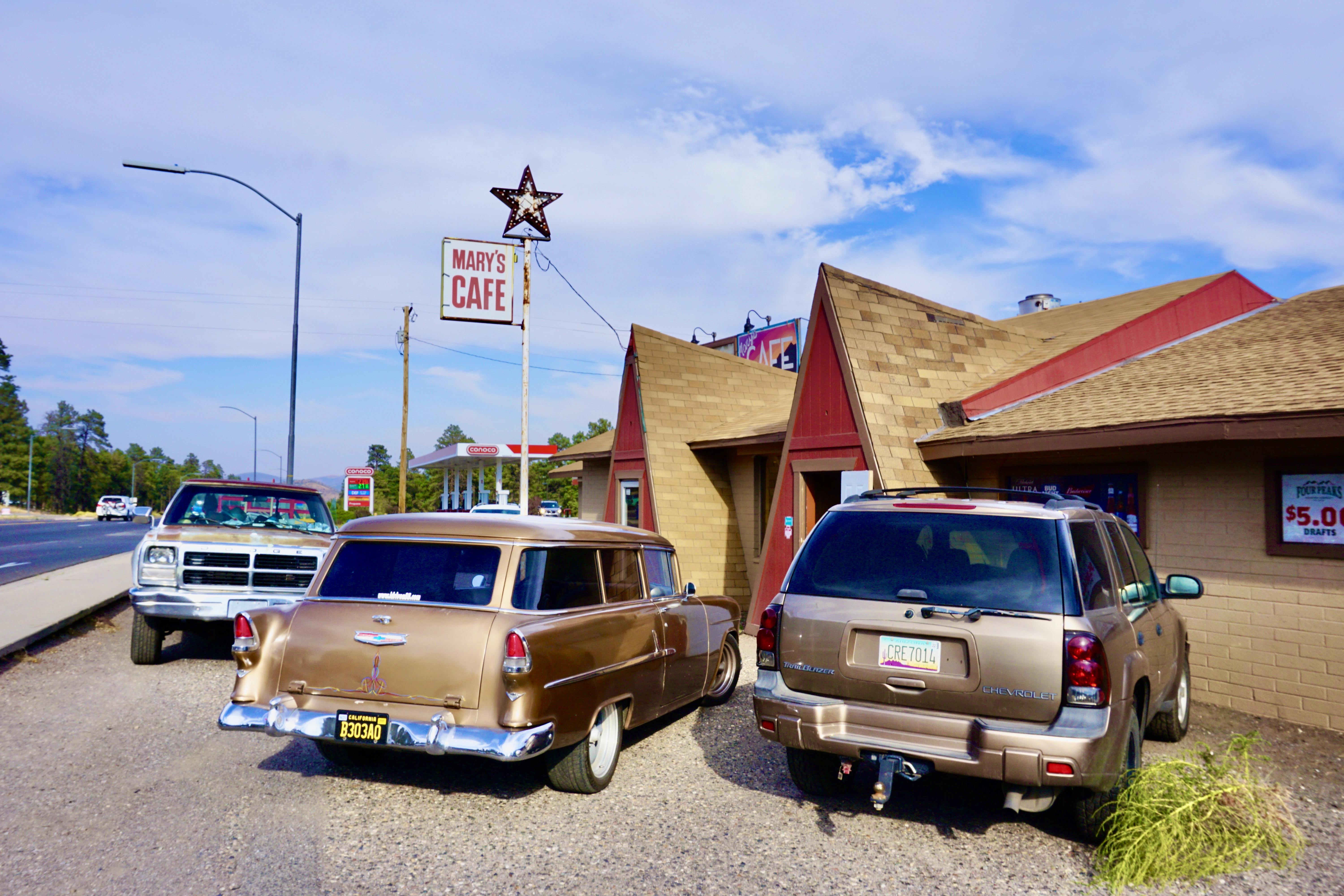
Mary’s Cafe is where they picked up “the girl” in “Two Lane Blacktop.”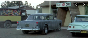
“Two Lane Blacktop” is about nothing except two guys in a 1955 Chevy gasser with a fire-breathing big-block and a Muncie M22 racing a guy in a GTO across the country.
It’s pretty awesome.
My favorite part is listening to that BBC & M-22 make music together.
If you don’t know Two Lane Blacktop – go see it.
After Mary’s Cafe I stopped off at the Western Hills Motel for a quick picture.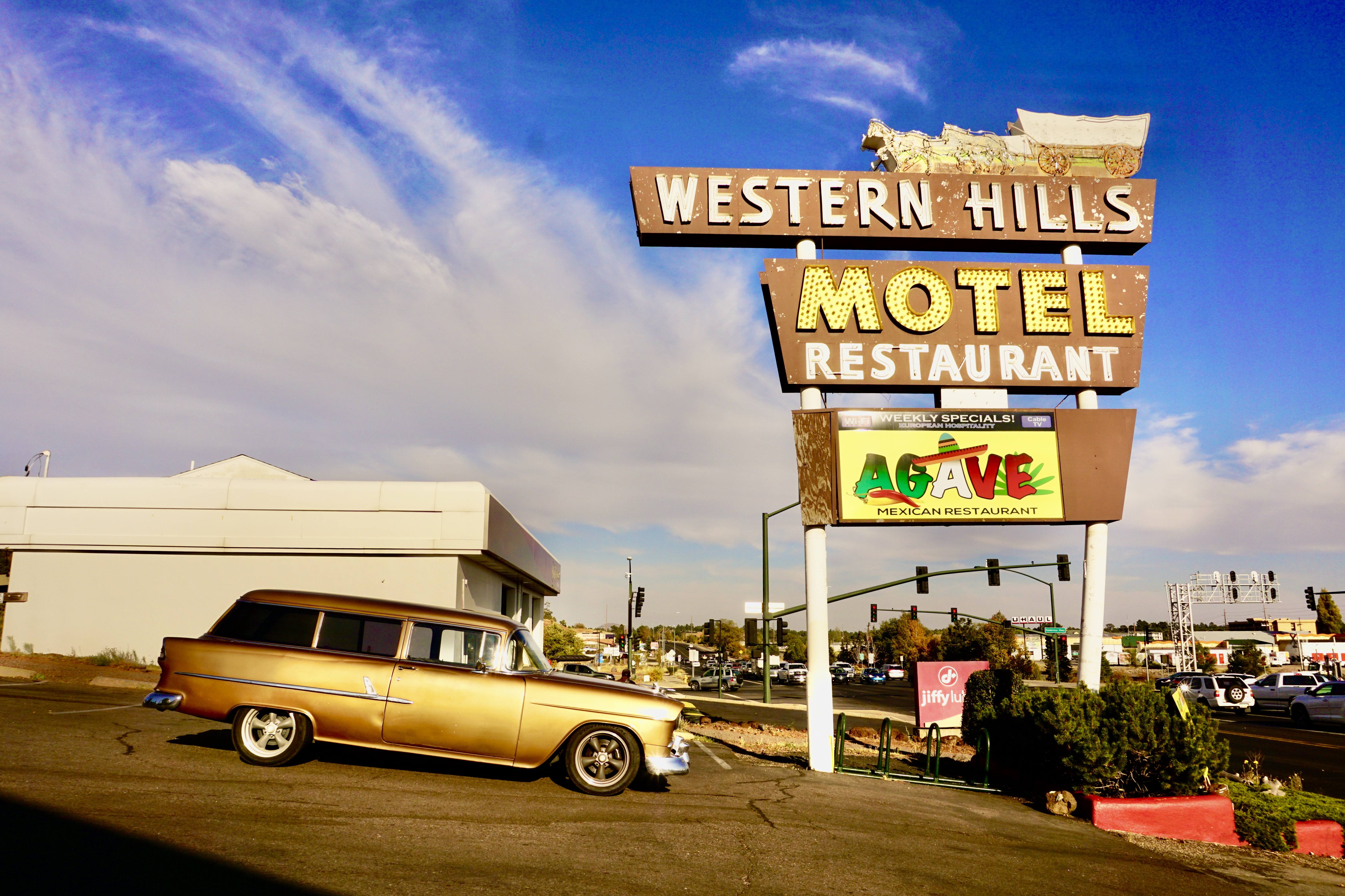
A few miles outside of Flagstaff is even more Hollywood gold.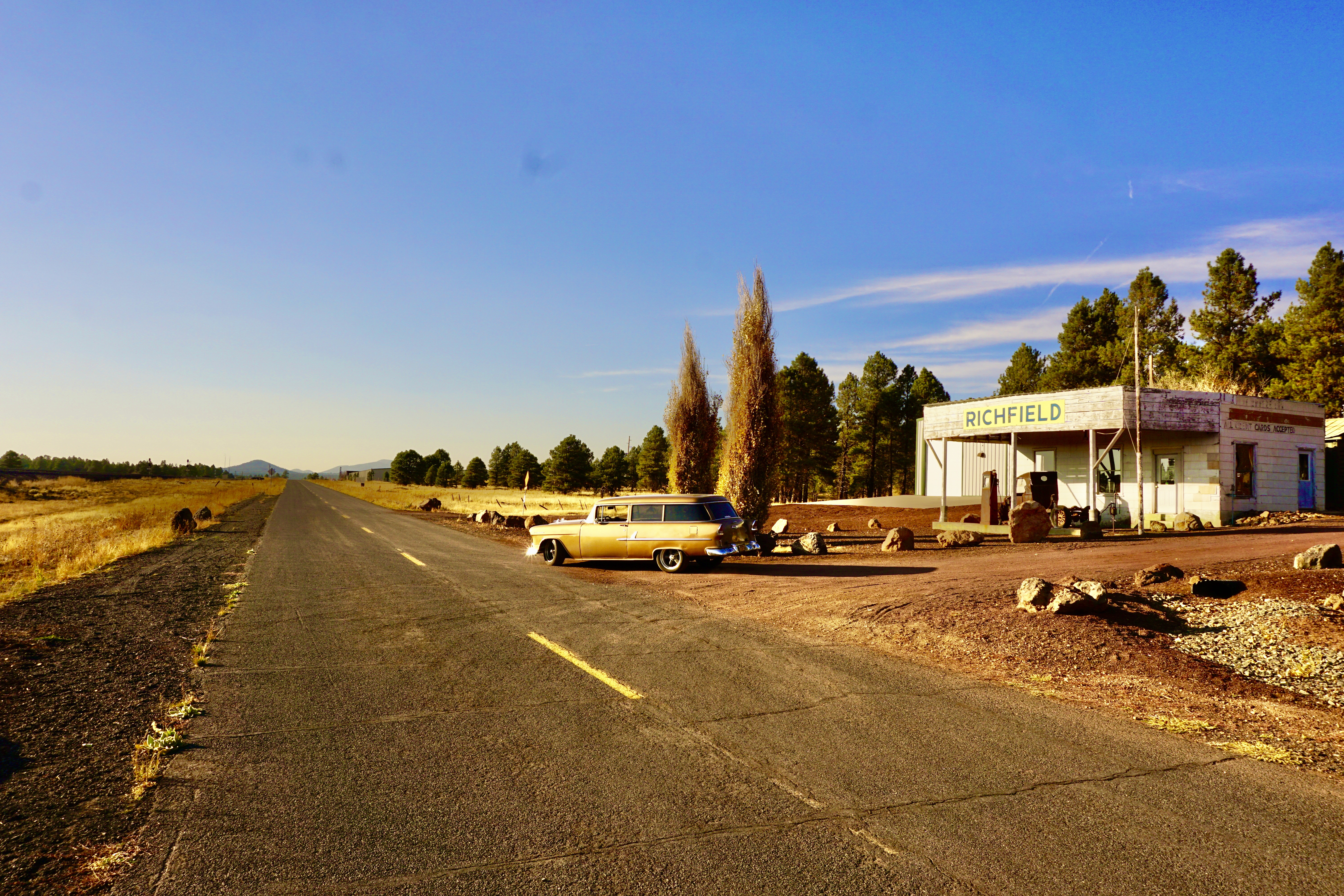
The motel at the beginning of “Easy Rider” that they’re turned away from.
Pretty cool right?
Seligman was our next stop.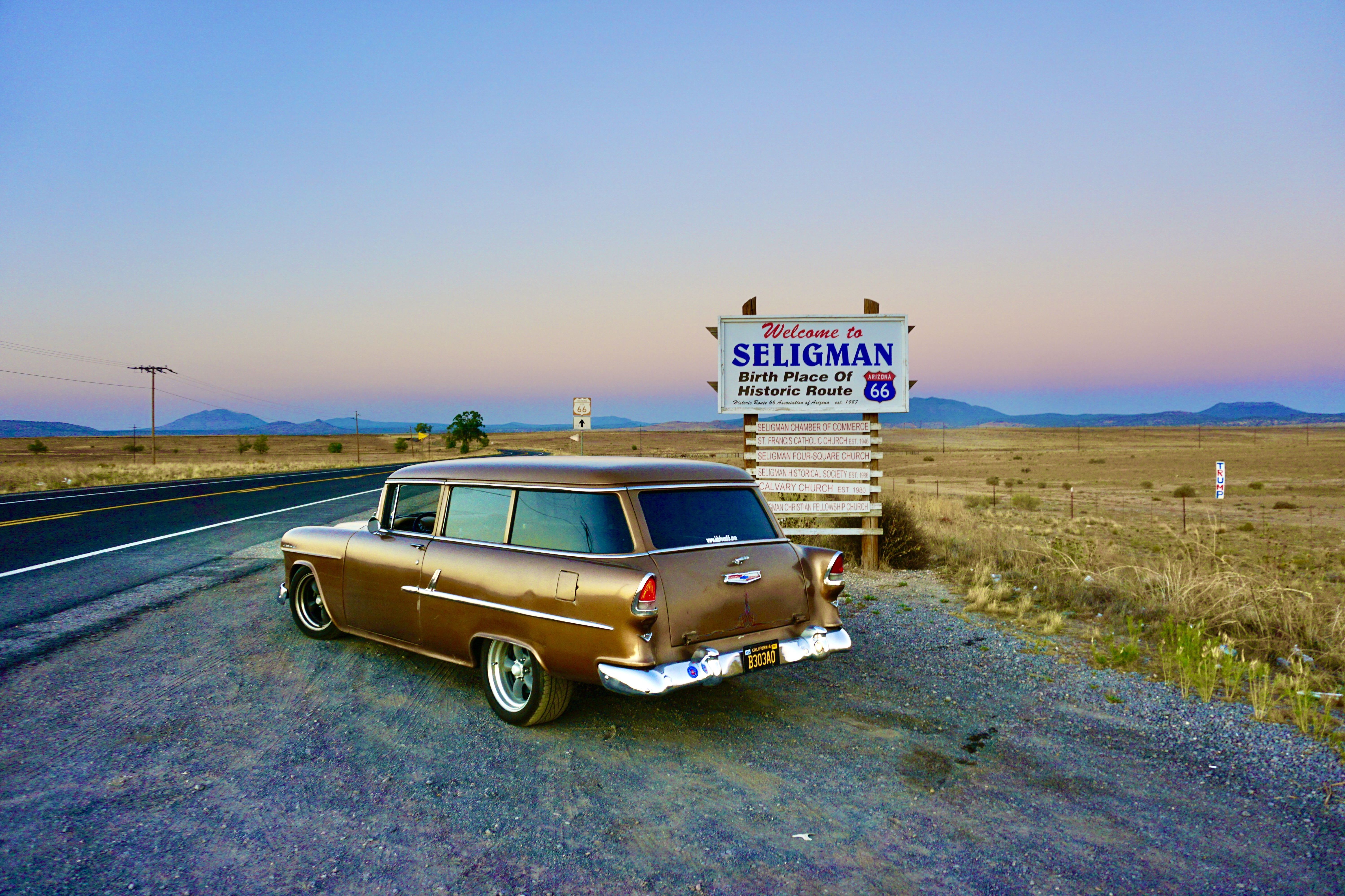
There’s always something cool to see in Seligman.
Like the Supai Motel.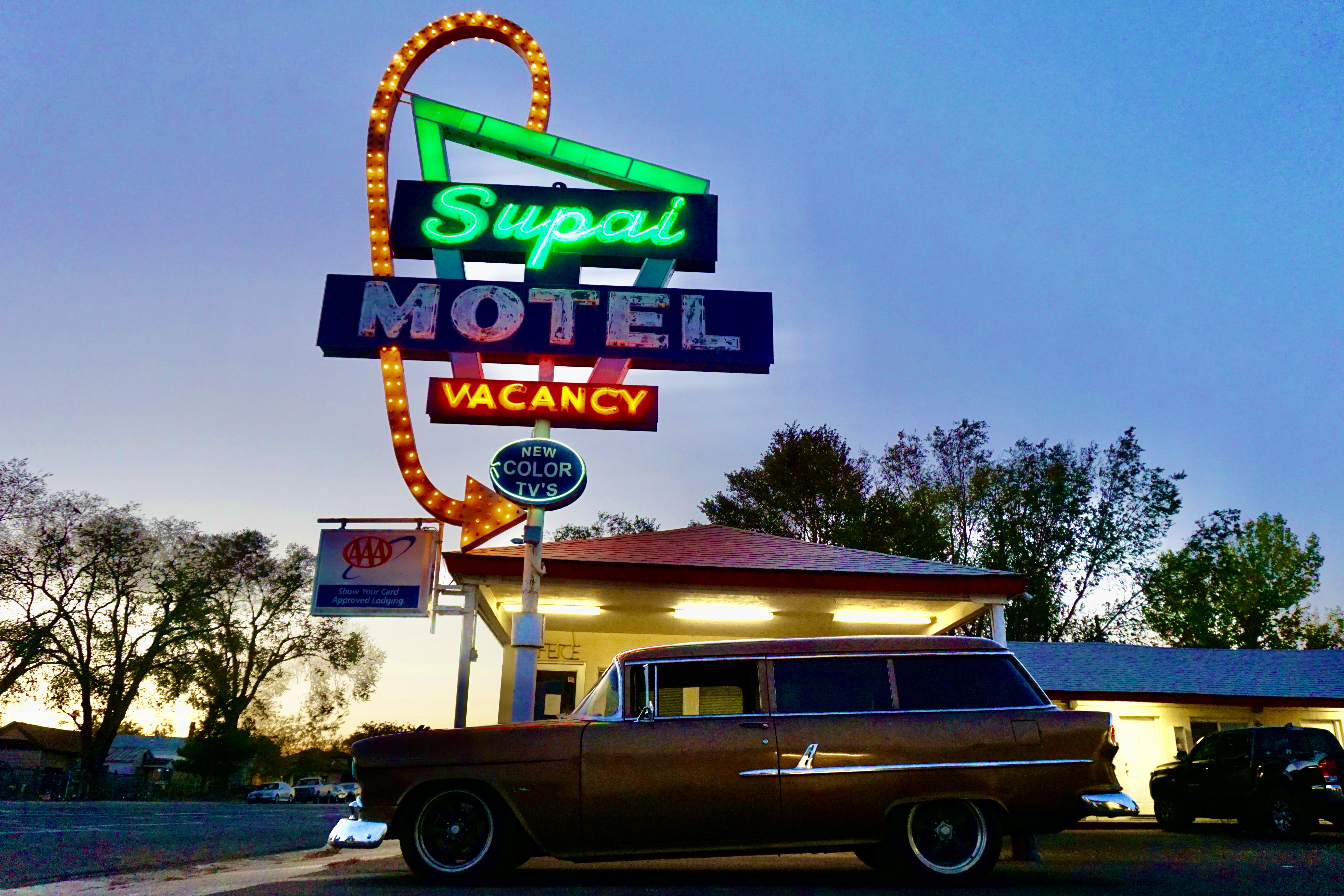
When I got out to take some pictures I heard the guy inside the Motel office say “nice car.”
Then, as if on cue, they turned on the neon lights for me.
Sweeeeeeet!!
It was “Miller Time” and Seligman’s neon lights were coming on.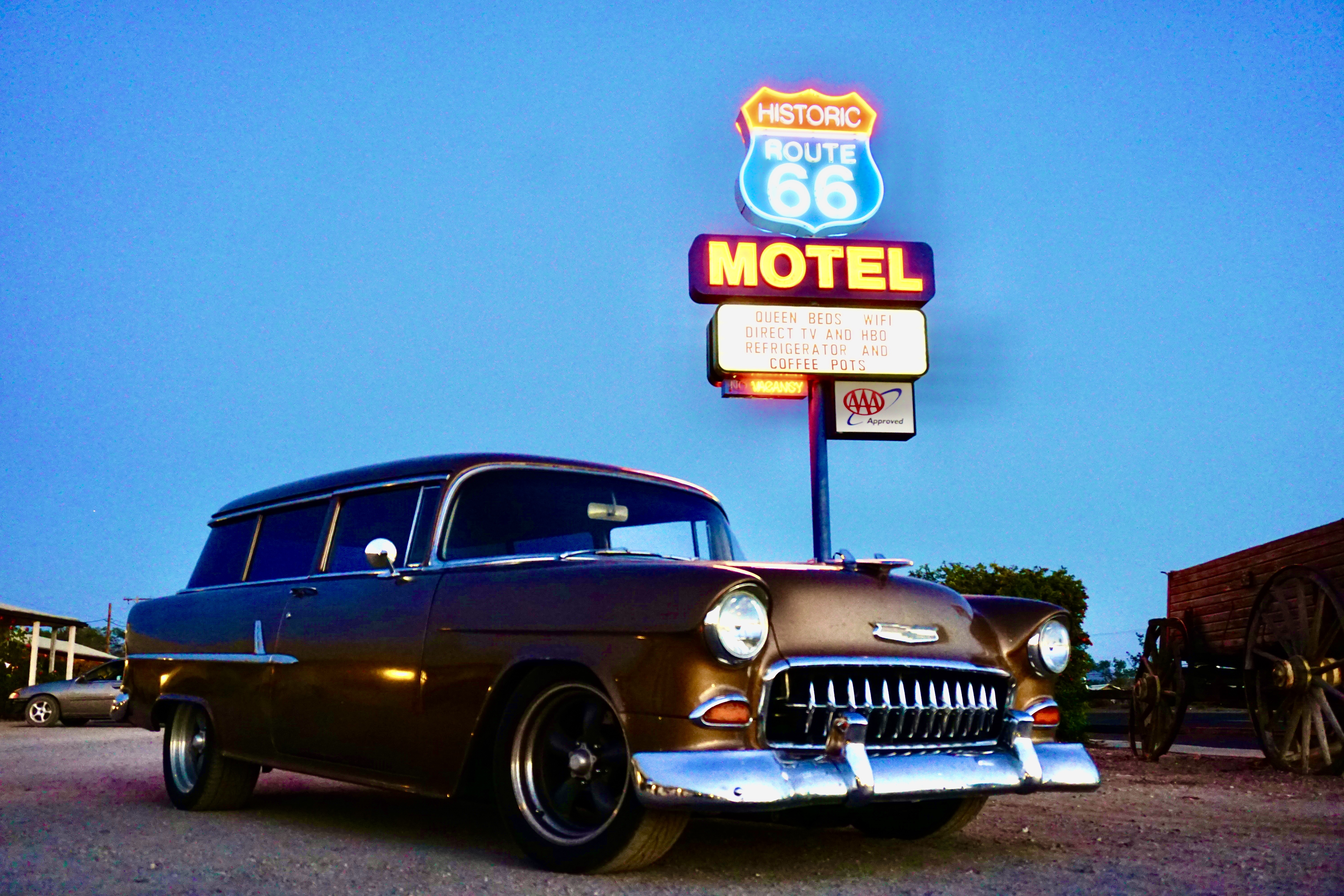
I was getting hungry so we stopped in for a bite to eat at the Roadkill Cafe.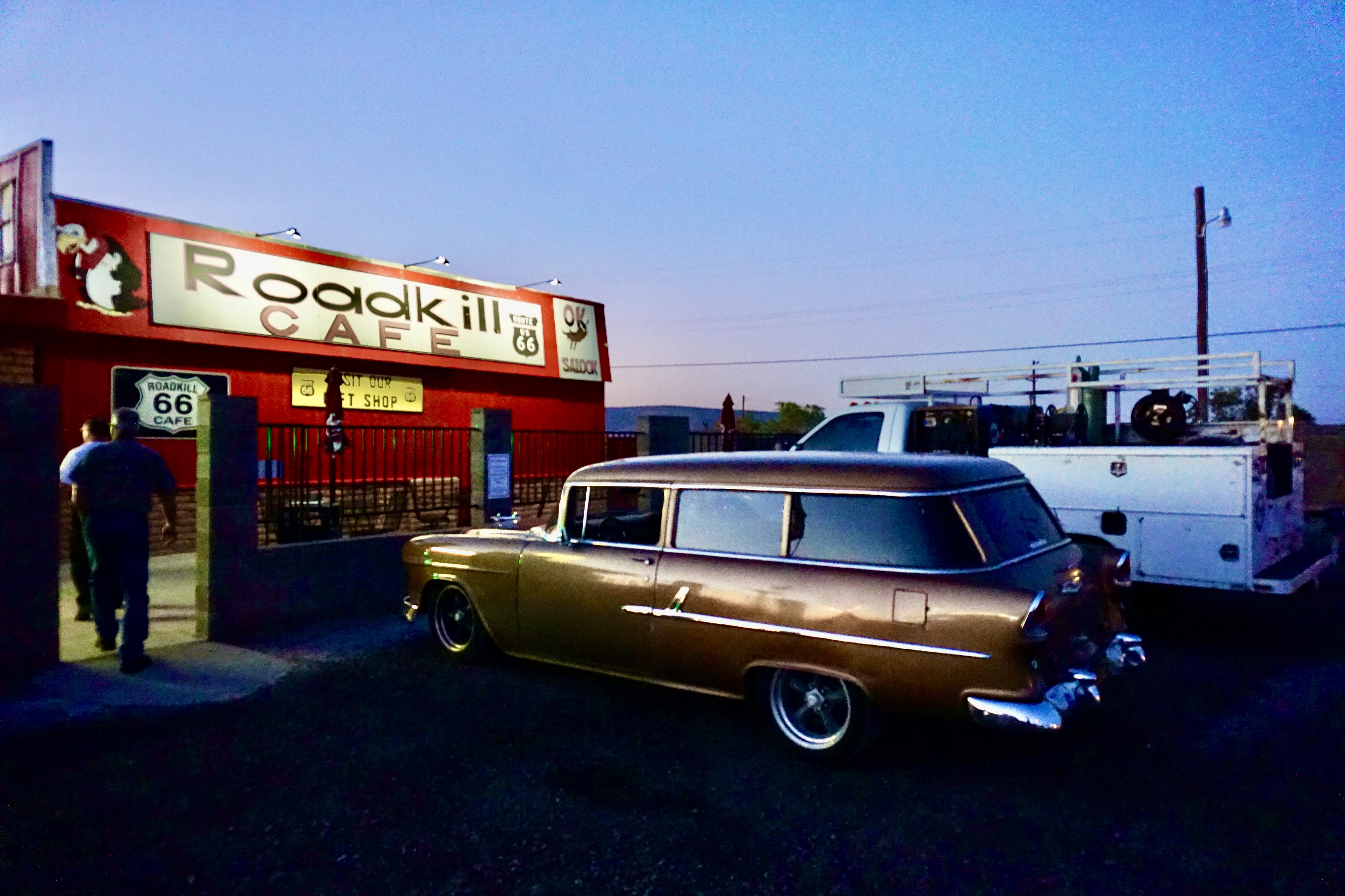
After filling my belly with delicious chicken tenders I was on my way.
It was dark when I left the Roadkill Cafe so I spent the night in Peach Springs and found this the next morning. 
Right across the street from the Frontier Motel.
Down the road and around the bend is the Hackberry General Store.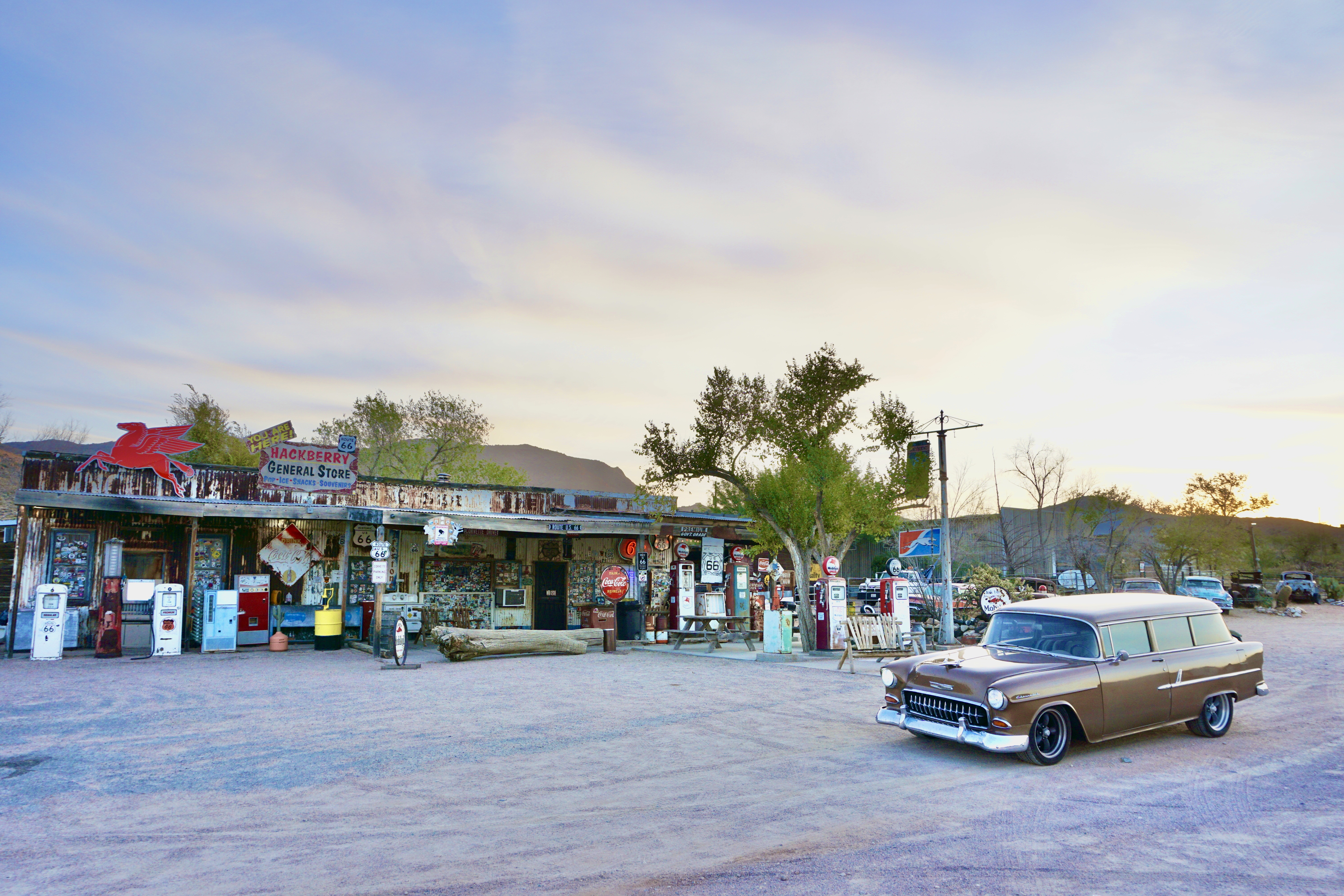
It’s called the “Mother Load of Mother Road Memorabilia.”
A few miles further is Kingman.
In Kingman you can pick up Interstate 40 but I stayed on Route 66 and was rewarded with the El Trovatore Motel sign.
Down the hill from the El Trovatore I got the Kingman Post Office.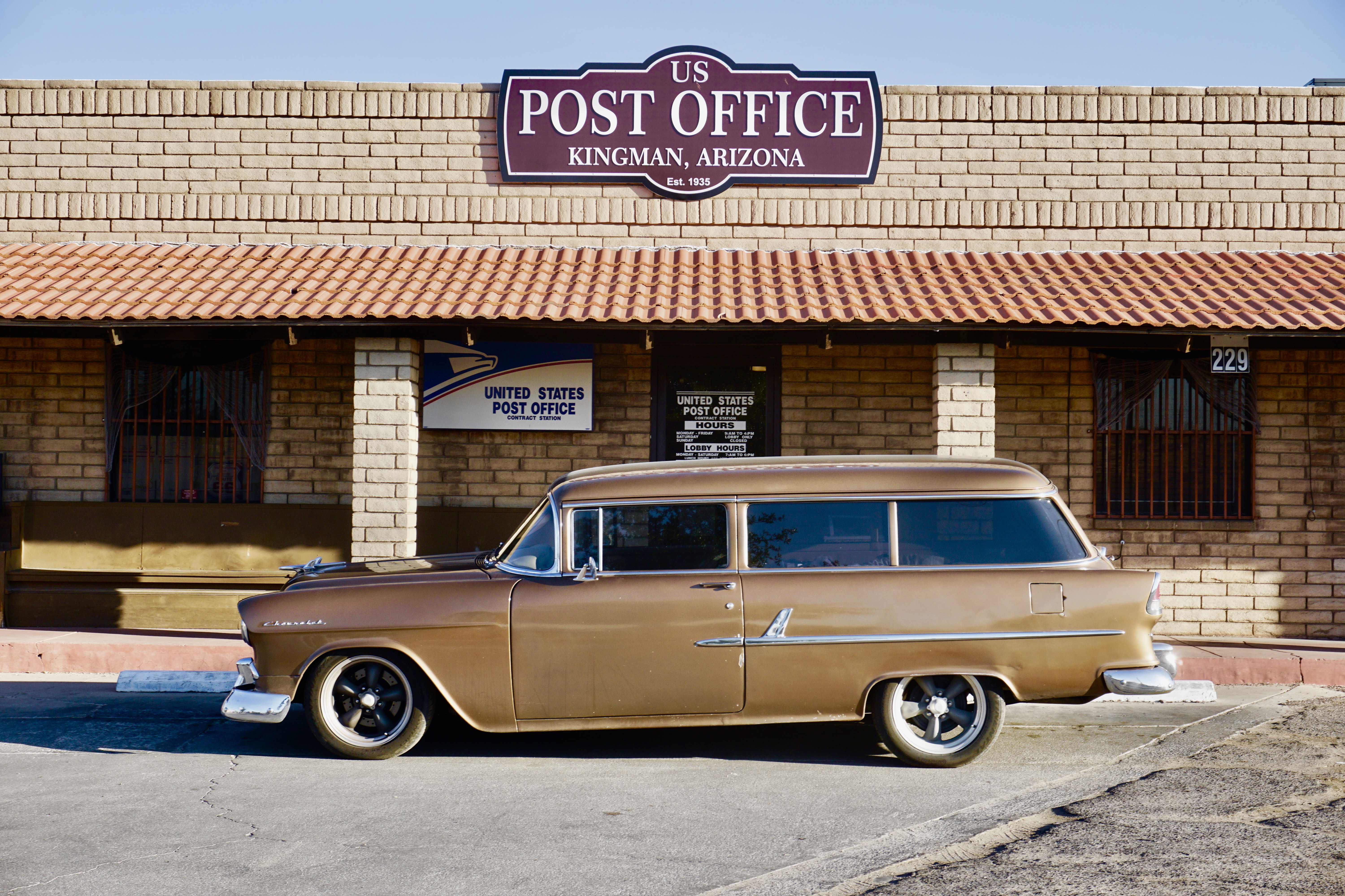
Score!!
And the Old Trails Garage.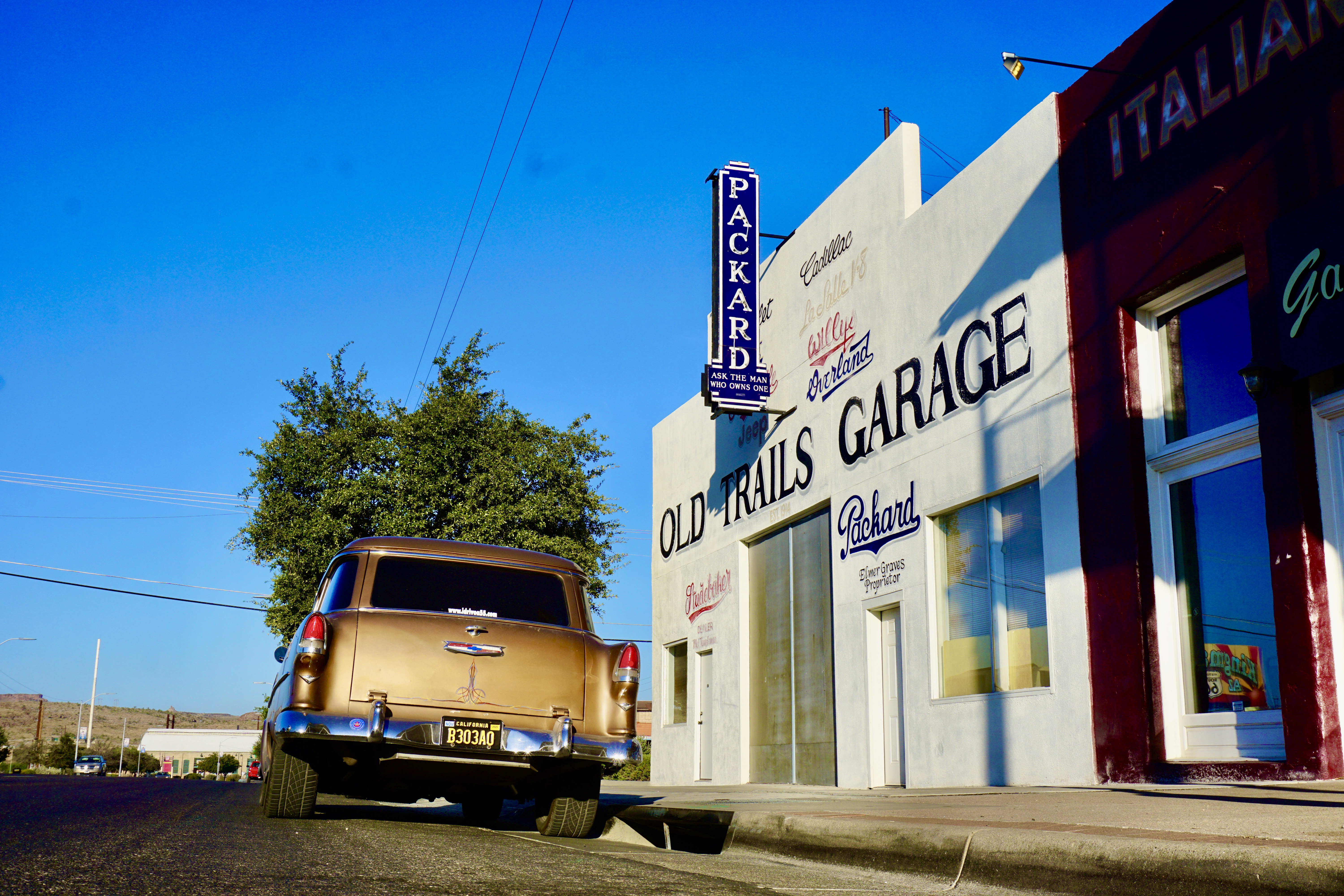
Check out that vintage Packard sign.
I followed Andy Devine Road thru Kingman and made the left to continue onto Route 66.
After going under the freeway we made another left onto the Oatman Highway.
This is where Route 66 starts to get into its groove.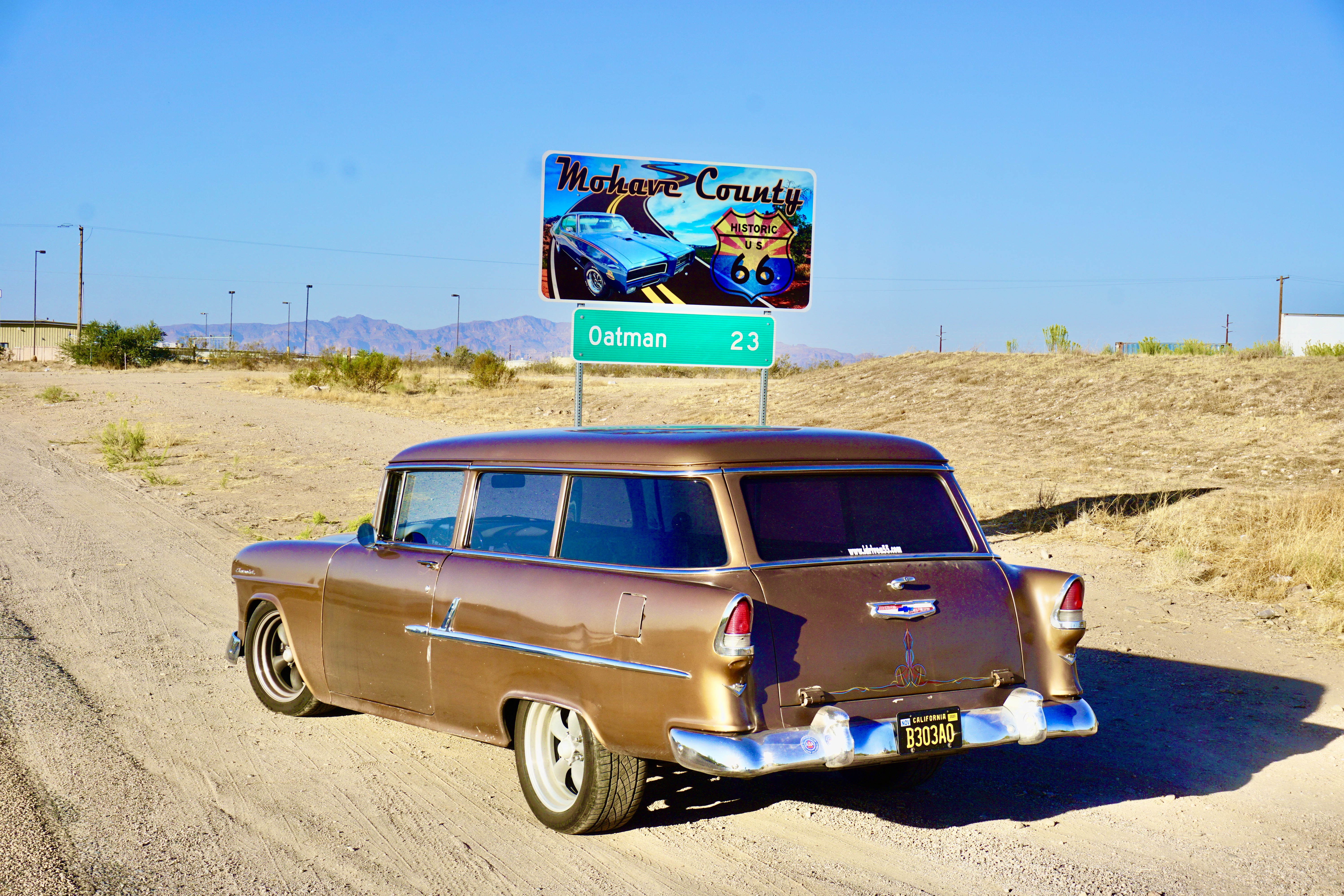
The next 23 miles are the real deal.
Historic Old Route 66 at its finest.
This is the part of Route 66 that’s a Federally designated as an “All-American Road.” 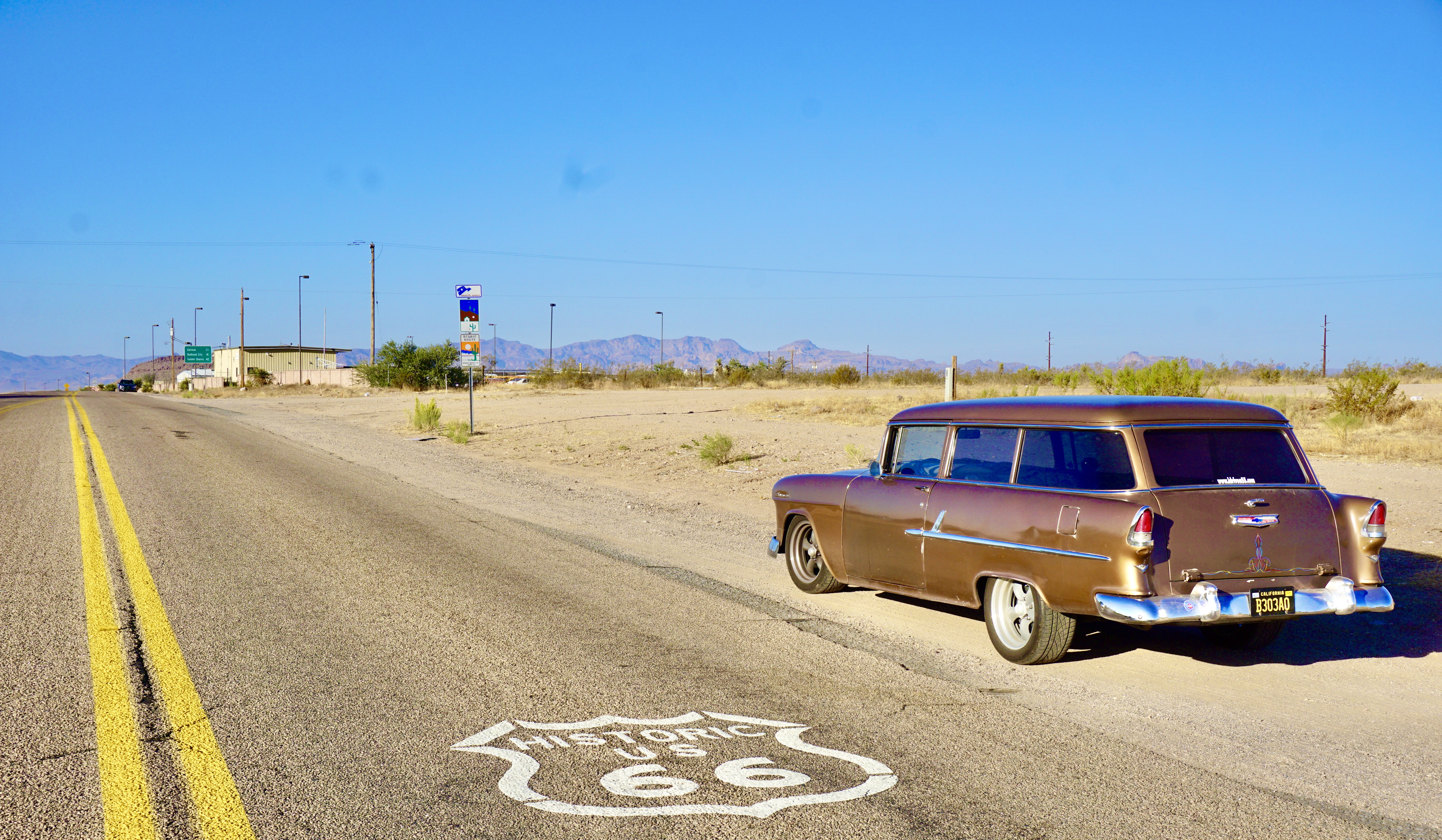
With good reason.
The road starts off in a lightly populated neighborhood that reminded me of the Pixar movie “Cars.”
Then you arrive at the Cool Springs camp and service station. 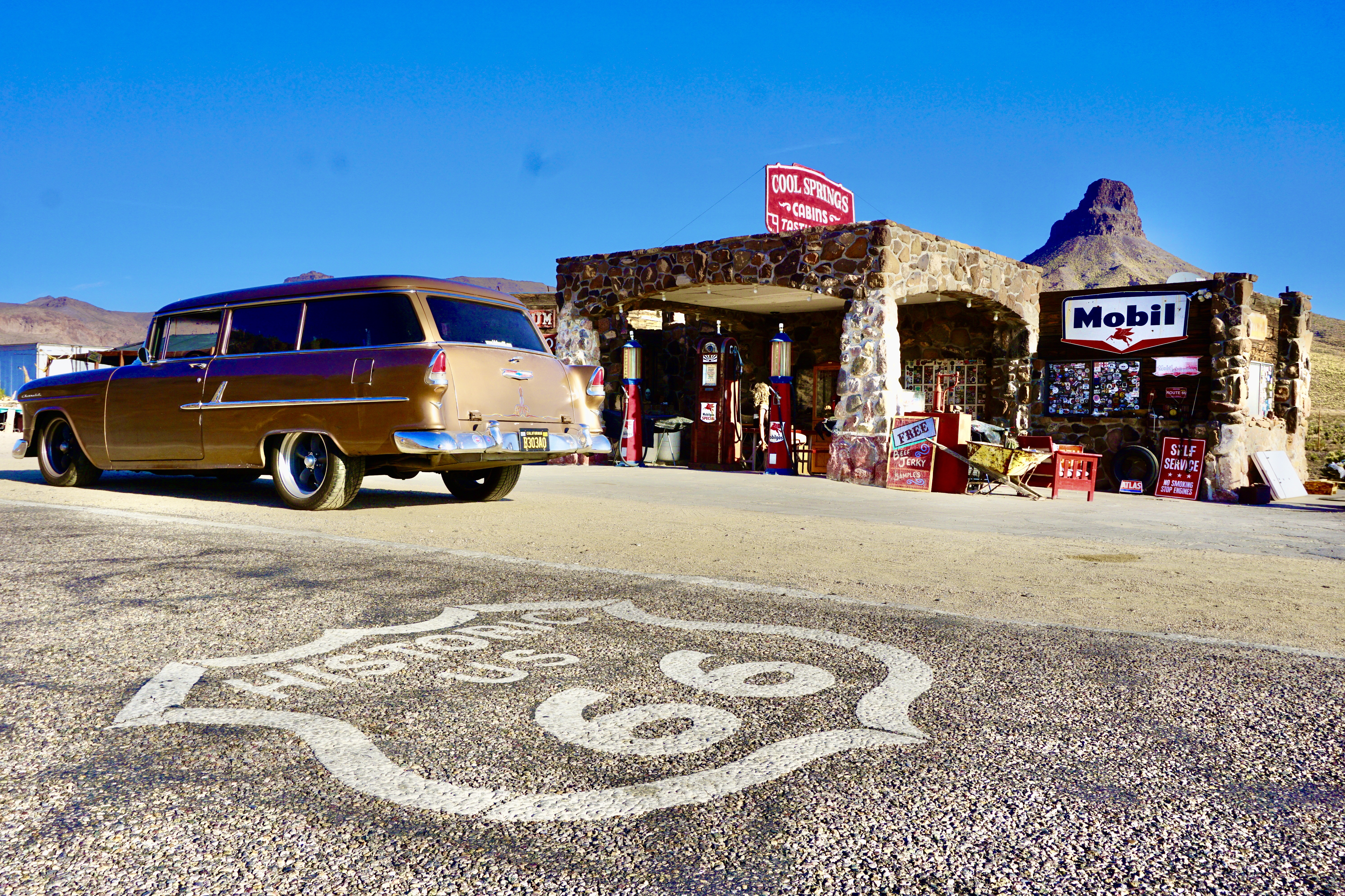
Cool Springs was built in the mid-20’s and it was an oasis for motorists back in the day.
From Cool Springs, Route 66 winds into one of the most spectacular sections of road I’ve driven on.
It’s narrow and steep with hairpin curves that have a speed limit of 10 mph.
I laughed out loud when we got to the summit of Sitgreaves Pass – it’s only 3586 feet.
After going up Independence Pass at 12,095 feet – 3586 feet is a walk in the park for The 55.
After Cool Springs I kept on seeing what looked like horse manure on the road.
Then I remembered – Oatman is notorious for having wild mules wandering around town.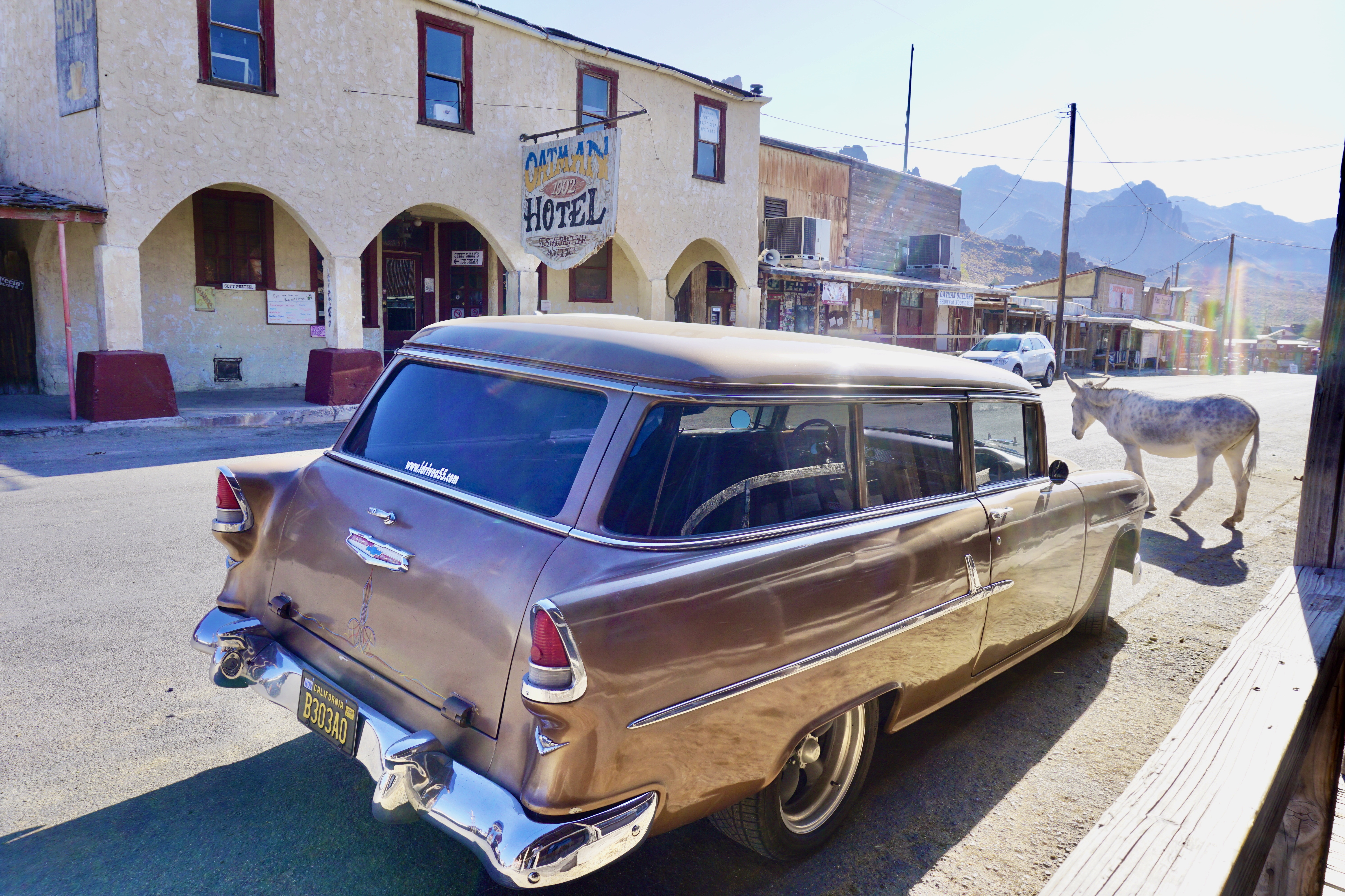
They’re very friendly.
Driving this section of road is really like driving back in time.
Especially when you’re driving a 1955 Chevy and you’re the only one on the road.
You know I had to get the Oatman Post Office.
From Oatman we made our way to Needles, CA.
Our first stop in Needles was El Garces.
Built in 1906, the railroad spared no expense building this lavish depot.
It’s now in disrepair, but it is listed on the National Register of Historic Places.
Just under the highway I found another awesome gas-station.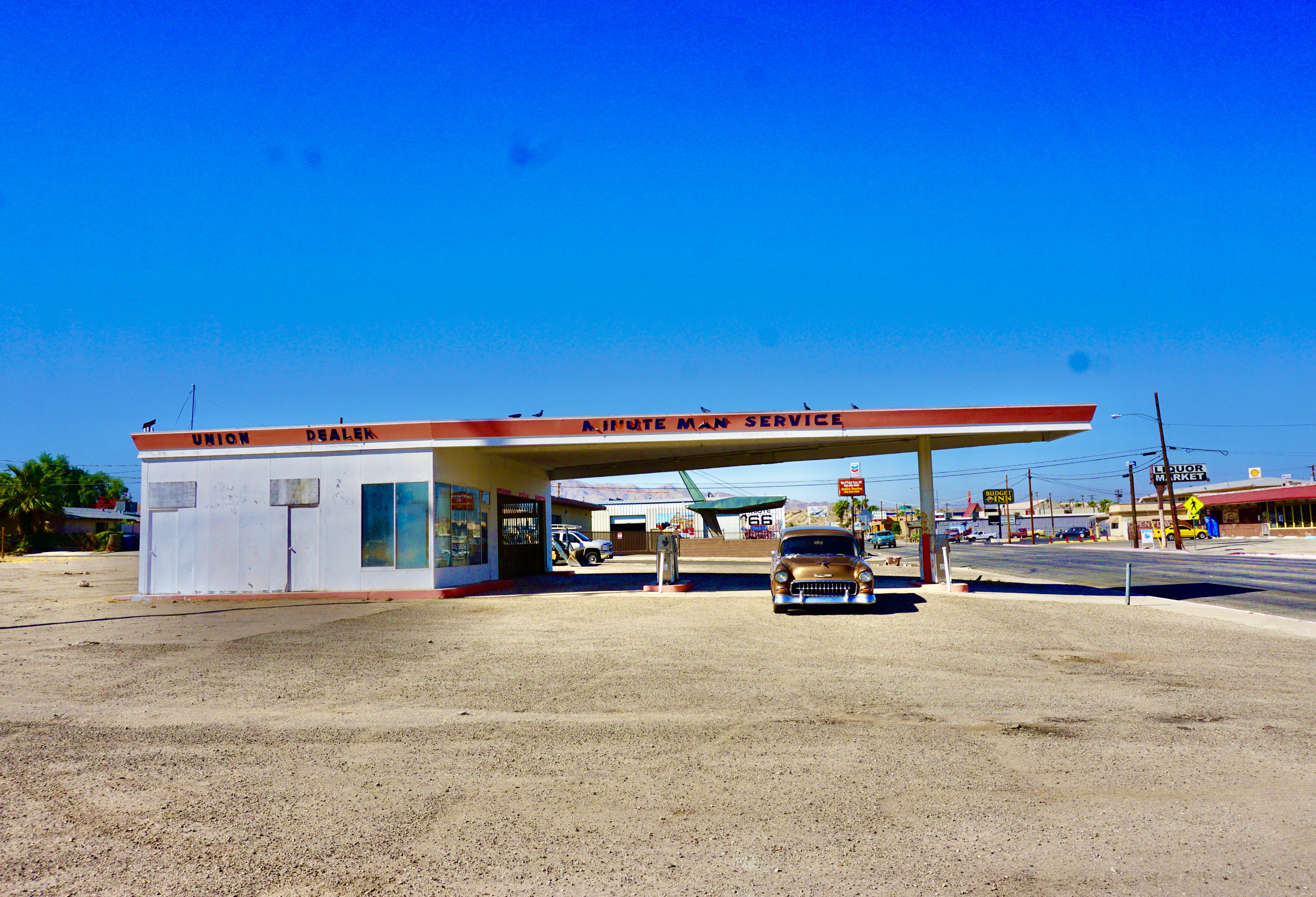
I love these old Phillips 66 “batwings.”
They’re all over – you’ve just gotta keep your eyes open.
Oh yeah – check out that cantilevered roof in the background.
After Needles I had to get back onto the interstate.
I exited I-40 at Kelbaker road drove south to Roys on Route 66 in Amboy.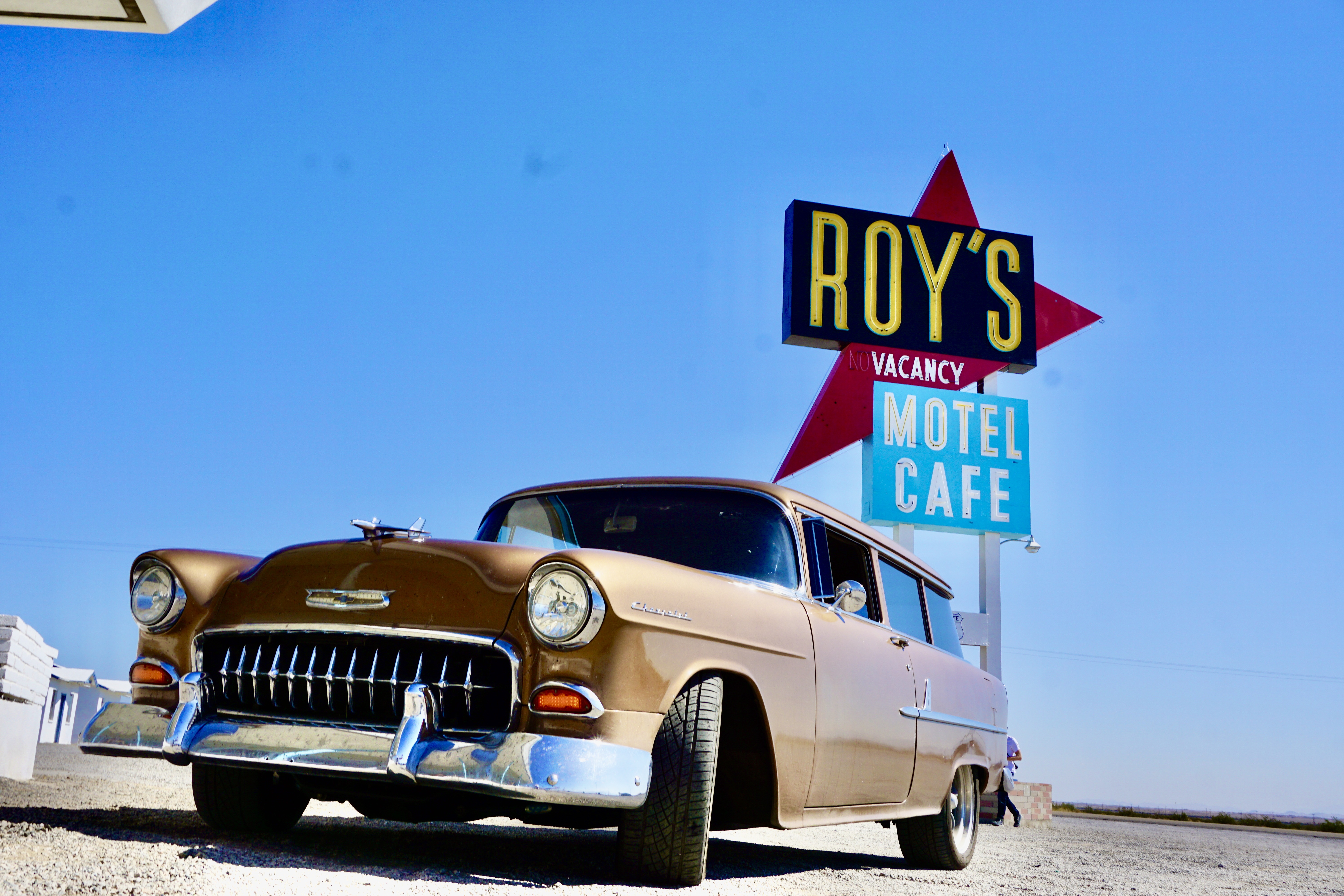
There’s so much good stuff at Roy’s I had to go back for more.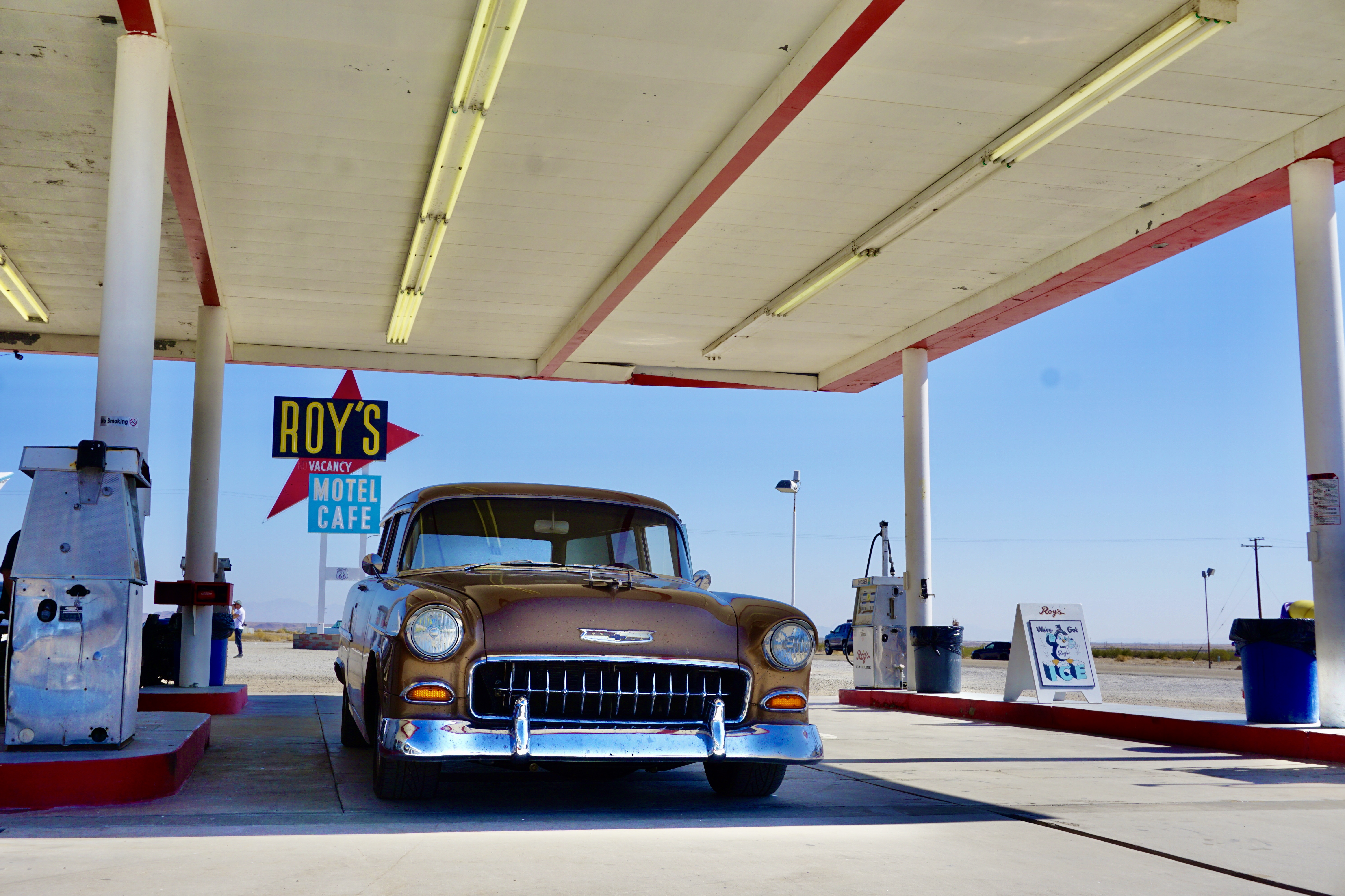
See what I mean?
After Roy’s I stayed on Route 66 until I was forced back onto I-40.
But not before getting this sign.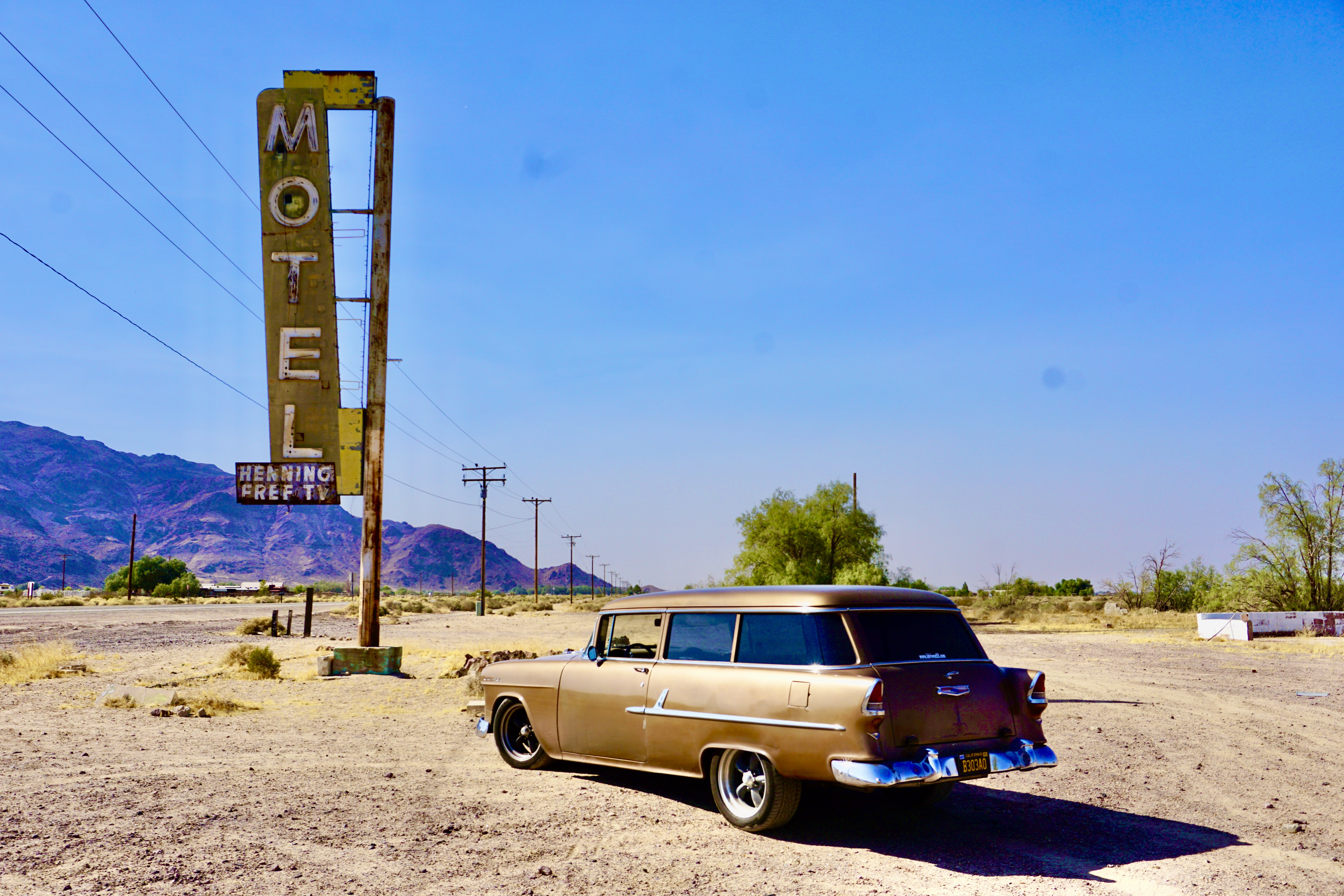
We got back on the interstate and headed to LA.
It was three days, over 1000 miles and lots of cool stuff.
Did I miss anything?
Let me know – I’m heading back to Colorado in a few weeks.
Until then – I hope to see you out on the road.
Oh yeah – prints of my photographs are available – so are coffee-table books at www.idrivea55.com
#idrivea55


Great write-up of your road trip, I want to tag-along on one of them.
LikeLike
Thanks Piff buddy!! You can ride shotgun anytime.
LikeLike